The development of a system of housing indicators aimed to present a clear and objective pathway to develop public policies in the Brazilian context, specifically in the city of Campo Grande. This municipality in Mato Grosso Sul has an extension of 875,823 hectares (although the urban area covers 65,878 hectares) and has 785,450 inhabitants (according to the 2011 census), representing a medium-sized urban environment with a low population density compared to other contexts.
From a theoretical framework established through previous studies of policies on accessible housing, we have identified relevant indicators for constructing a comprehensive database and analysis methodology – tailored to the unique context and available resources of Campo Grande.
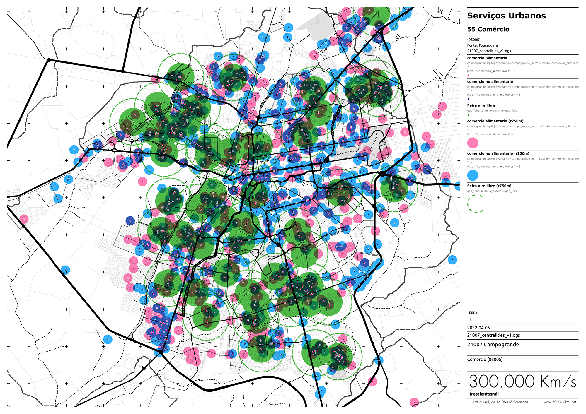
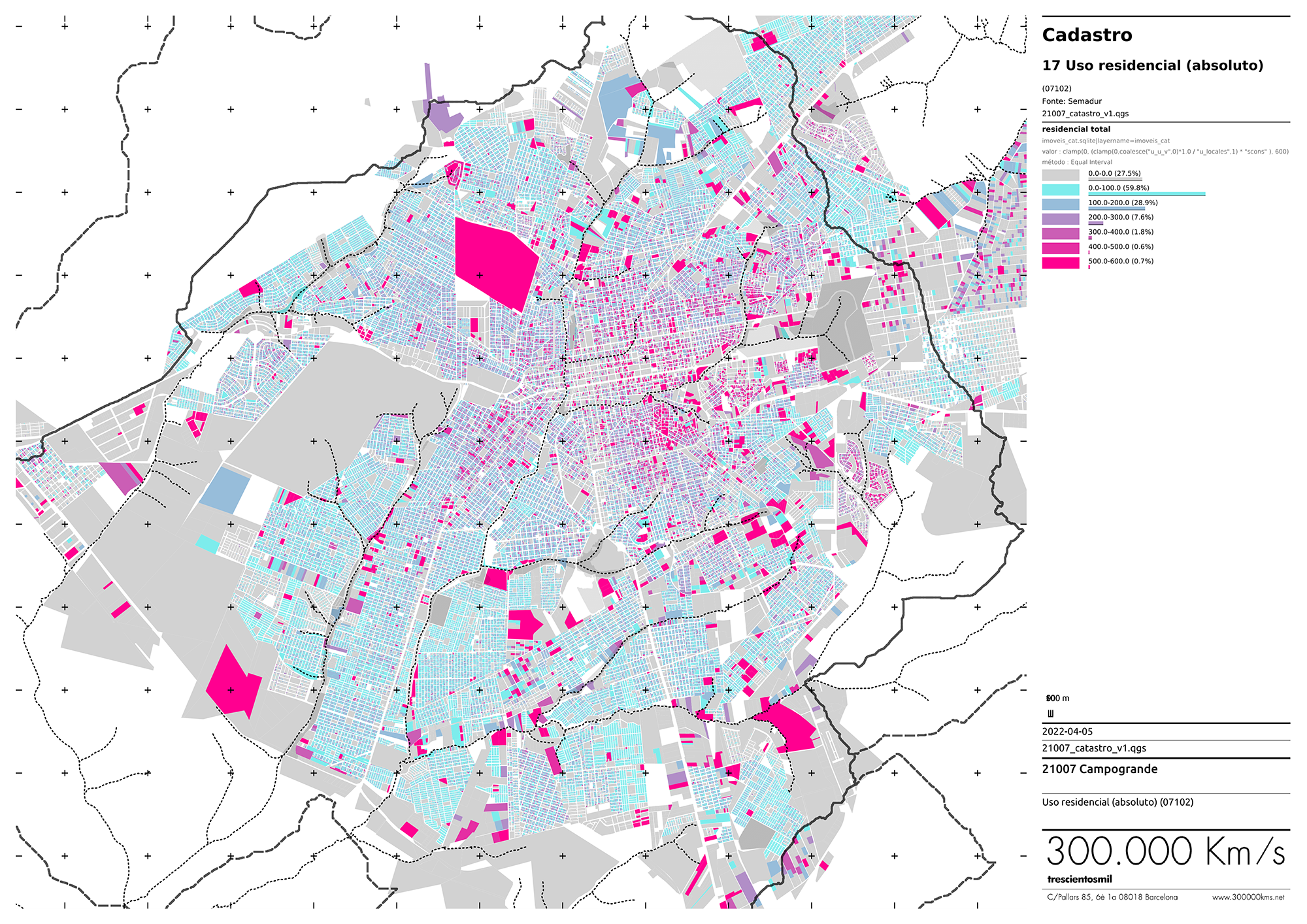
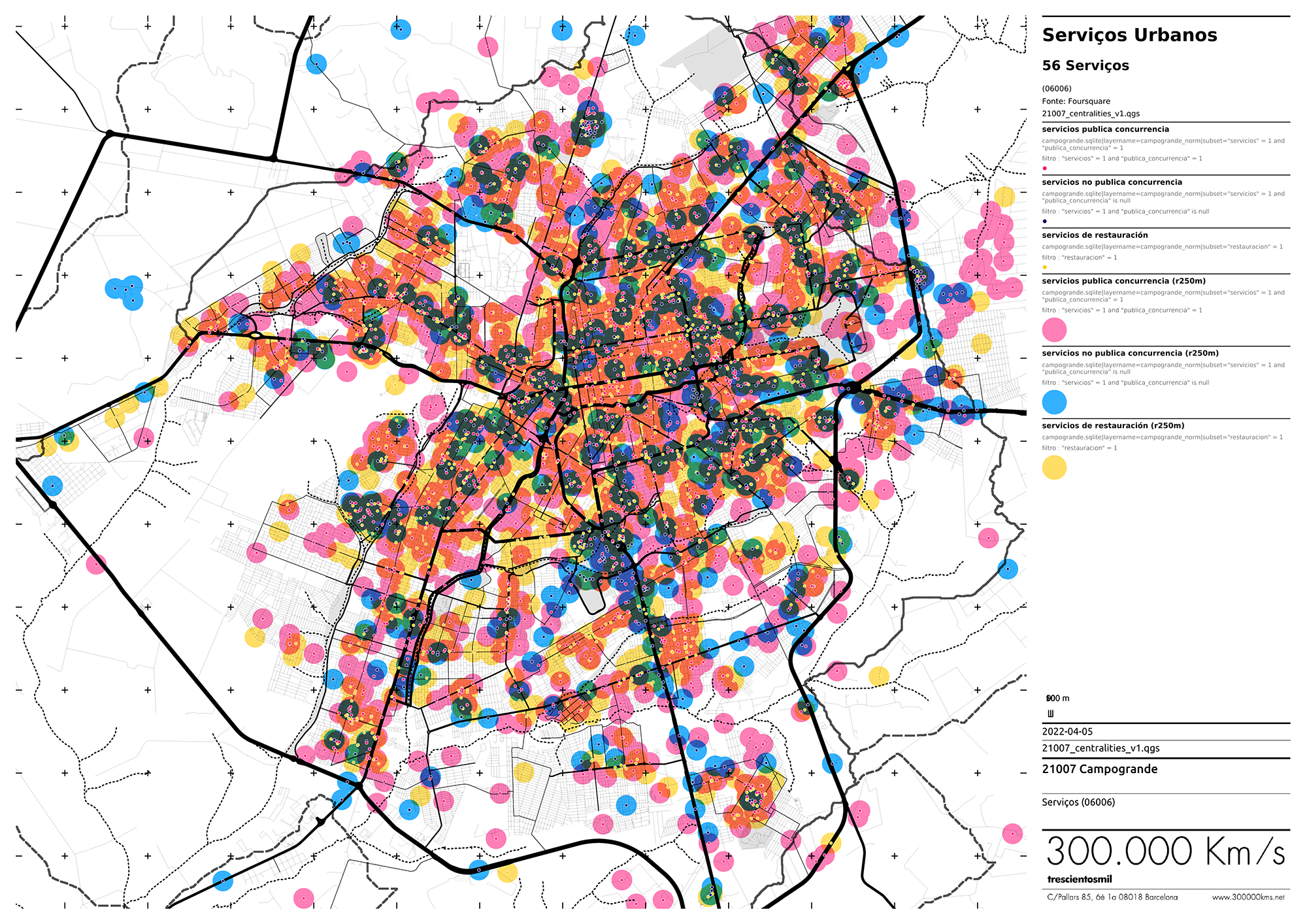
The primary information to build the indicators was gathered from different official Brazilian sources (including municipal, state and federal data) and other unstructured data sources such as online platforms. This allowed the integration of all information in a structured manner and the creation of an unprecedented map of the city’s complexities.
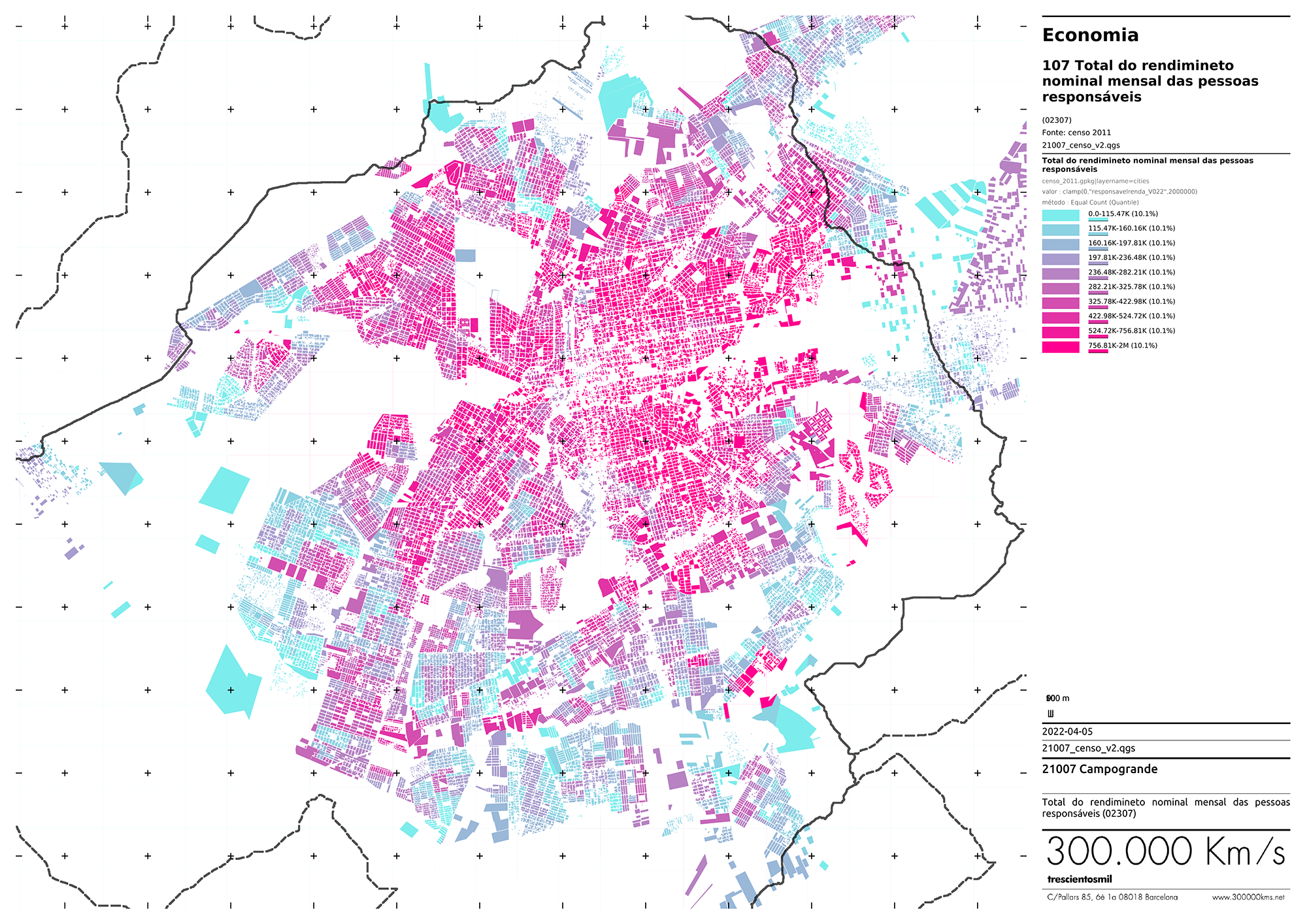
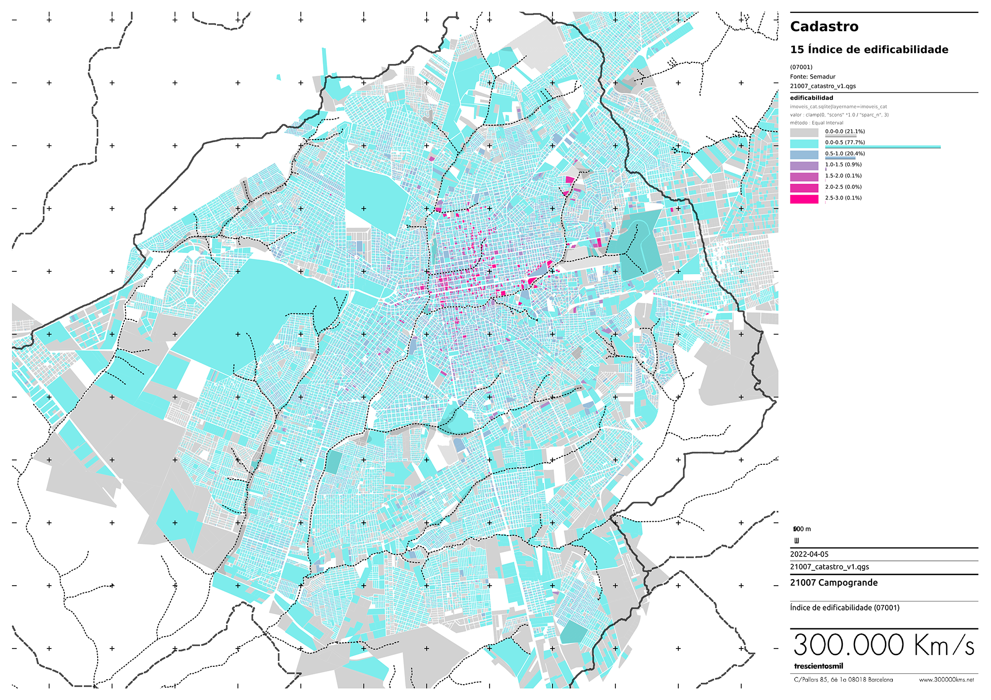
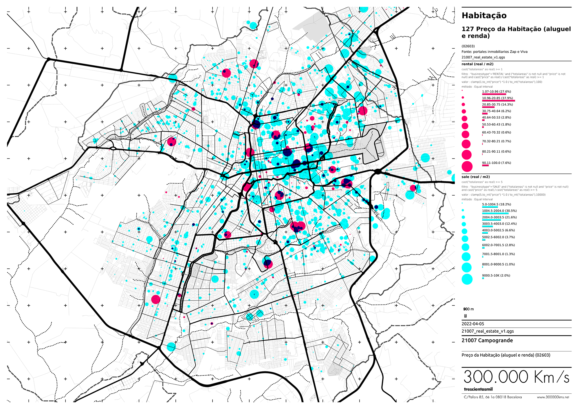
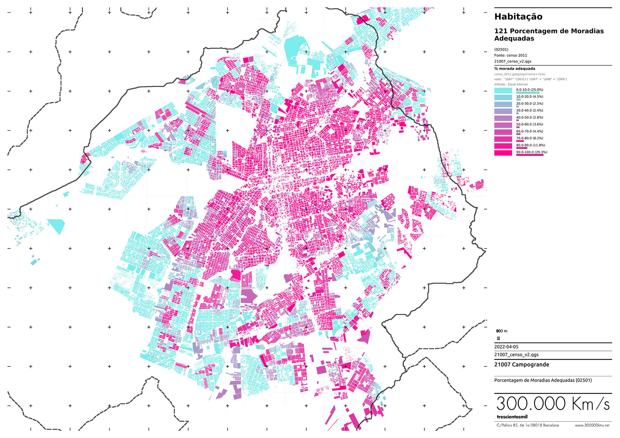
For example, we have collected data on land price, ownership, location, or risks that affect it; the dimension, quantity, quality, and services related to housing; the proximity to public transport, amenities and services. In addition, we have included a demographic and socioeconomic vulnerability description.
As a result of this data identification work (together with the municipal teams of Campo Grande), the matrix of indicators provides an urban perspective of housing policies. On the one side, it defines the best zones to allocate new housing. On the other side, the indicators help to identify the regeneration needs of the existing housing stock.
Besides analyzing this data and calculating the proposed indicators, the framework provides a clear and concise visual representation of the main quantitative and spatial characteristics through a digital exploratory platform, which will inform future housing plans and decisions.
Images