
Today, Barcelona is undertaking one of the major systemic transformations in years. The Superblock strategy will restructure traffic to some big roads (drastically reducing pollution) and turn secondary streets into cien spaces for culture, leisure and the community. It will create walkable environments (complementing the existing ones) that will orchestrate the inhabitants’ daily life in proximity. In this context, the City Council needed a tool to understand how to frame this transformation and provide the necessary public facilities to support this new slow-mobility strategy.
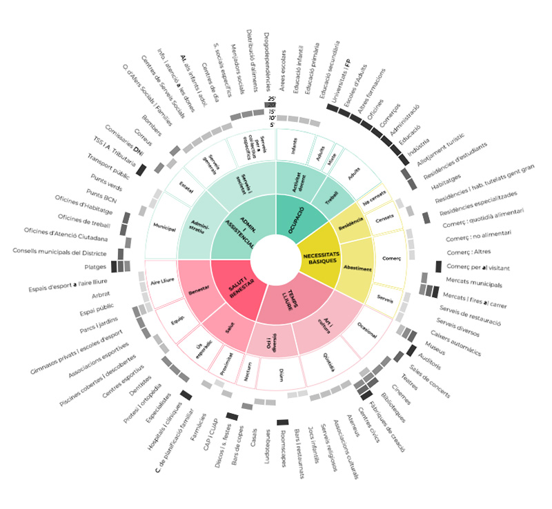
The ‘System of centralities’ (developed by 300.000 Km/s) in Barcelona proposes a systemic approach to the concept of proximity centrality, which is understood as the concentration of services, uses, and spaces that enable the proper development of various activities (residential, economic, cultural, etc.).
While for many years, this centrality concept has been associated with major urban transformations in the city, the centrality linked to residential fabrics is essential for managing mobility, improving family reconciliation, promoting a city focused on healthcare, fostering social relationships with neighbors, and more. Ultimately, it aims to make the immediate environment the place where all residents, regardless of their age, gender, or origin, can find everything they need for their daily lives, thereby contributing to quality of life and well-being.
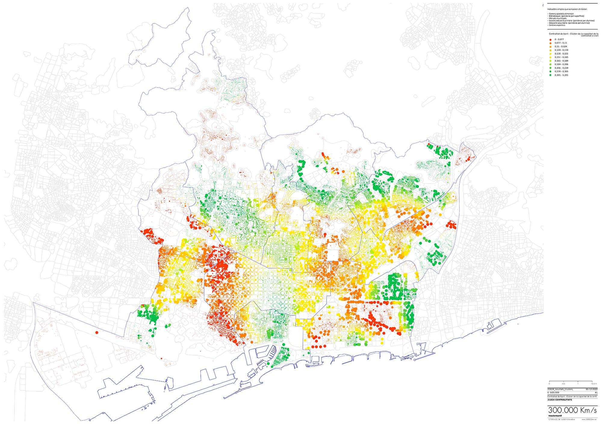
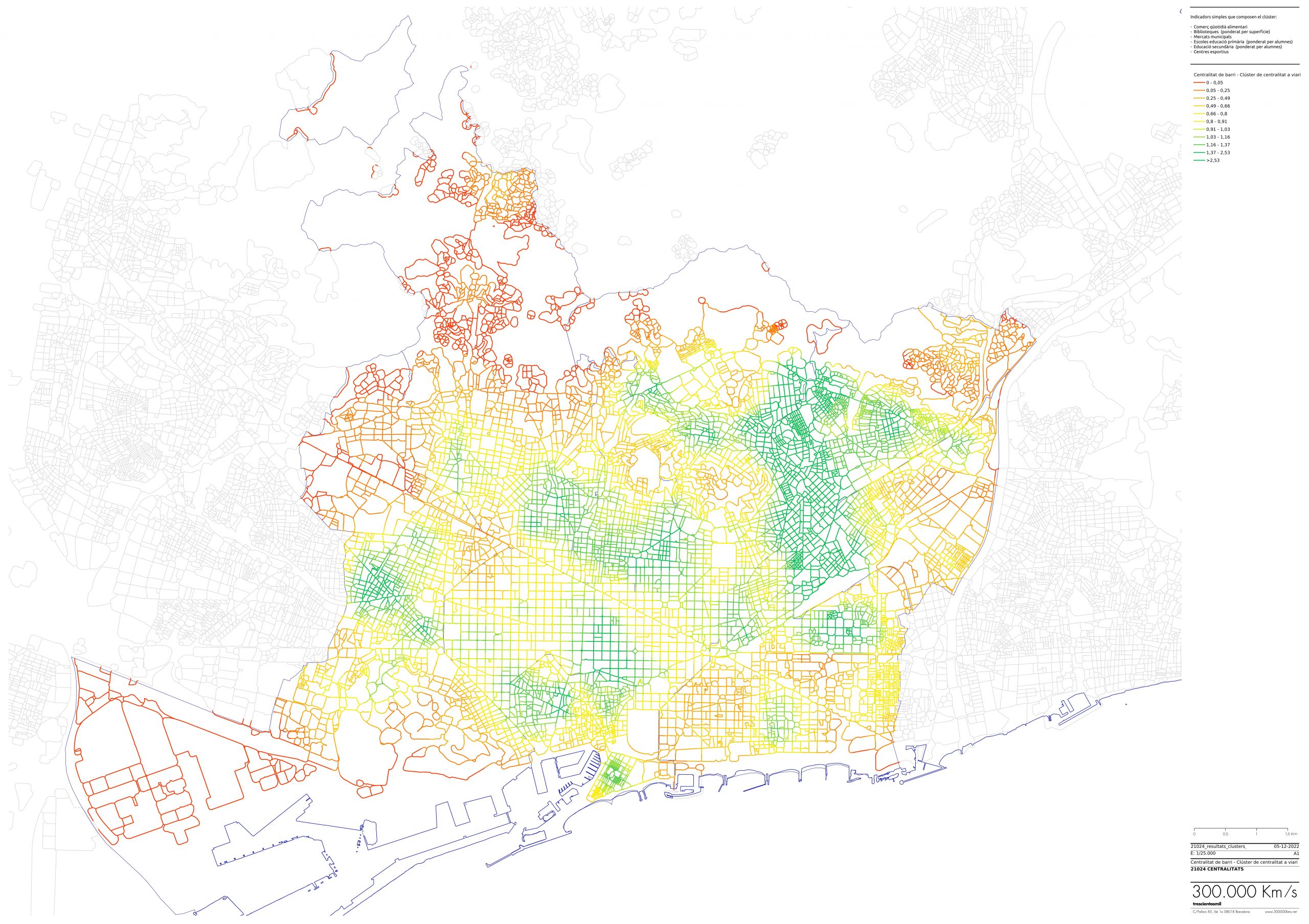
The study implements a methodology to quantify and characterize this concept through a digital twin of the city, allowing the identification of deficiencies and model environments to guide and prioritize various urban policies over time.
To achieve this, the study identifies the elements that constitute proximity centralities through a consultancy that evaluates the existing corpus of public data (and those that may be incorporated in the future). With this information, a digital model is constructed, enabling the assessment through simple and composite indicators that can be accessed via a dedicated digital tool.
In conclusion, the idea of centrality helps diagnose and quantify public space to promote an active mobility infrastructure. Behind a more walkable city model, a healthier city is being promoted transversally (by facilitating non-sedentary lifestyles) and the transition towards low-carbon models.
Images
Promoters
