
The research carried out in the project Nocturnal Landscapes: Urban Flows of Global Metropolises, curated by Iker Gil and organized by MAS Context, has materialized in a publication that collects the contents of the project’s exhibition in Chicago as well as new ones.
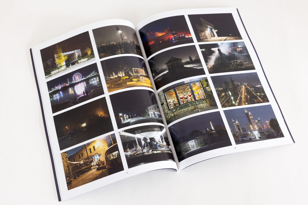
Nocturnal Landscapes: Urban Flows of Global Metropolises is a project that observes and analyzes cities at night from an interdisciplinary perspective. We have used data about urban life to compare the rhythms and regions of global cities through cartographic representations. The maps and graphics generated are complemented by the photographs of David Schalliol, photographer and sociologist, questioning the correlation of human activity and light, and revealing hidden aspects of our cities.
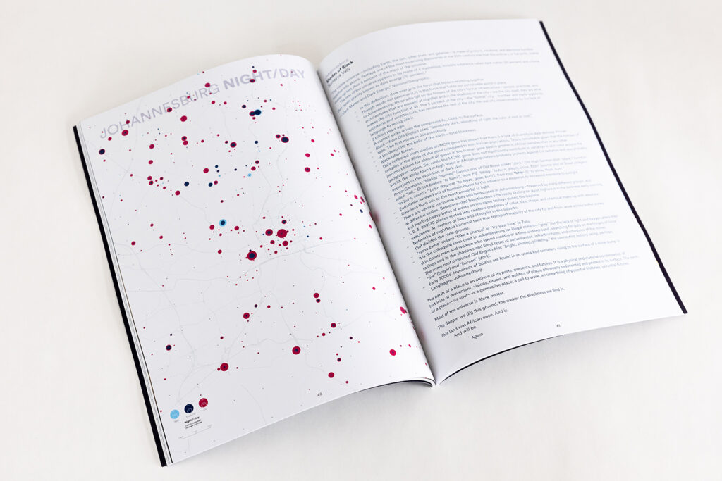
The large and continuous urban extensions, which characterize the world’s largest metropolises, become isolated fragments of light. These spots result from citizens’ activities. At the same time, they reveal places of collective symbolism (where monuments or large streets are profusely lit) and the areas where economic power is present through illuminated buildings and bright signs, conspicuous landmarks in the nocturnal landscape.
The project’s nighttime geographies are not only maps of light but also cartographies of darkness. Diagrams describe the shape of the city, how it is used, and who governs it. Drawings emphasize that darkness is more meaningful than light itself. If light embodies resence of activity, darkness denotes a noisy absence that requires further examination.
Aiming at rendering this duality visible, these cartographic series explore the relationship between citizens’ activity and urban lighting. On the one hand, we use massive data from Google platforms informing us of the percentage of the total capacity of each business located in the city (every day and every hour of the week). On the other hand, we also work with photographs taken by astronauts with their own cameras from the International Space Station. These images provide a level of detail not possible to obtain by current public satellites (Landsat and Sentinel). These cartographies describing our world were unimaginable only a few years ago. Today, they are a reality thanks to published data
available to everyone.