
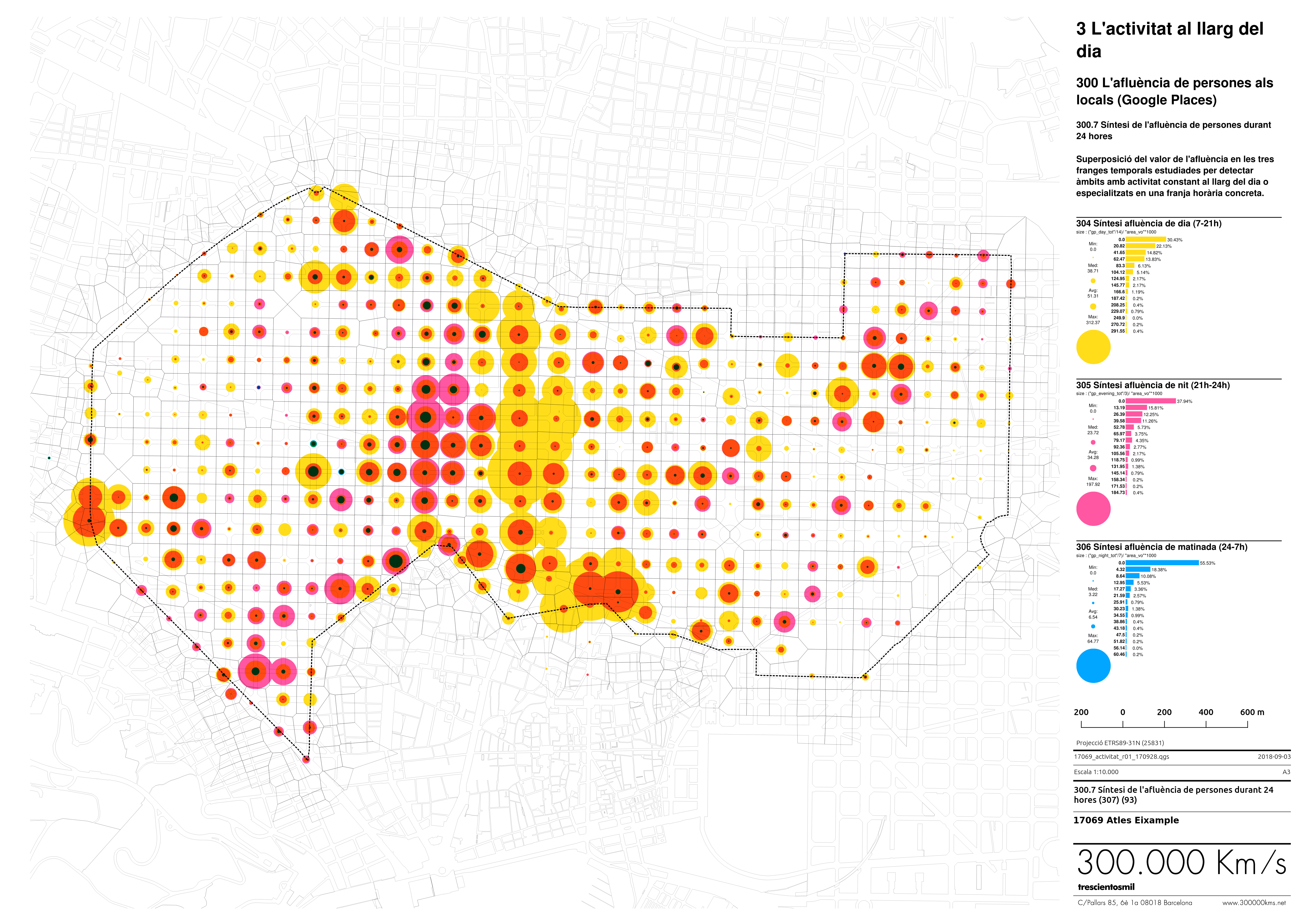
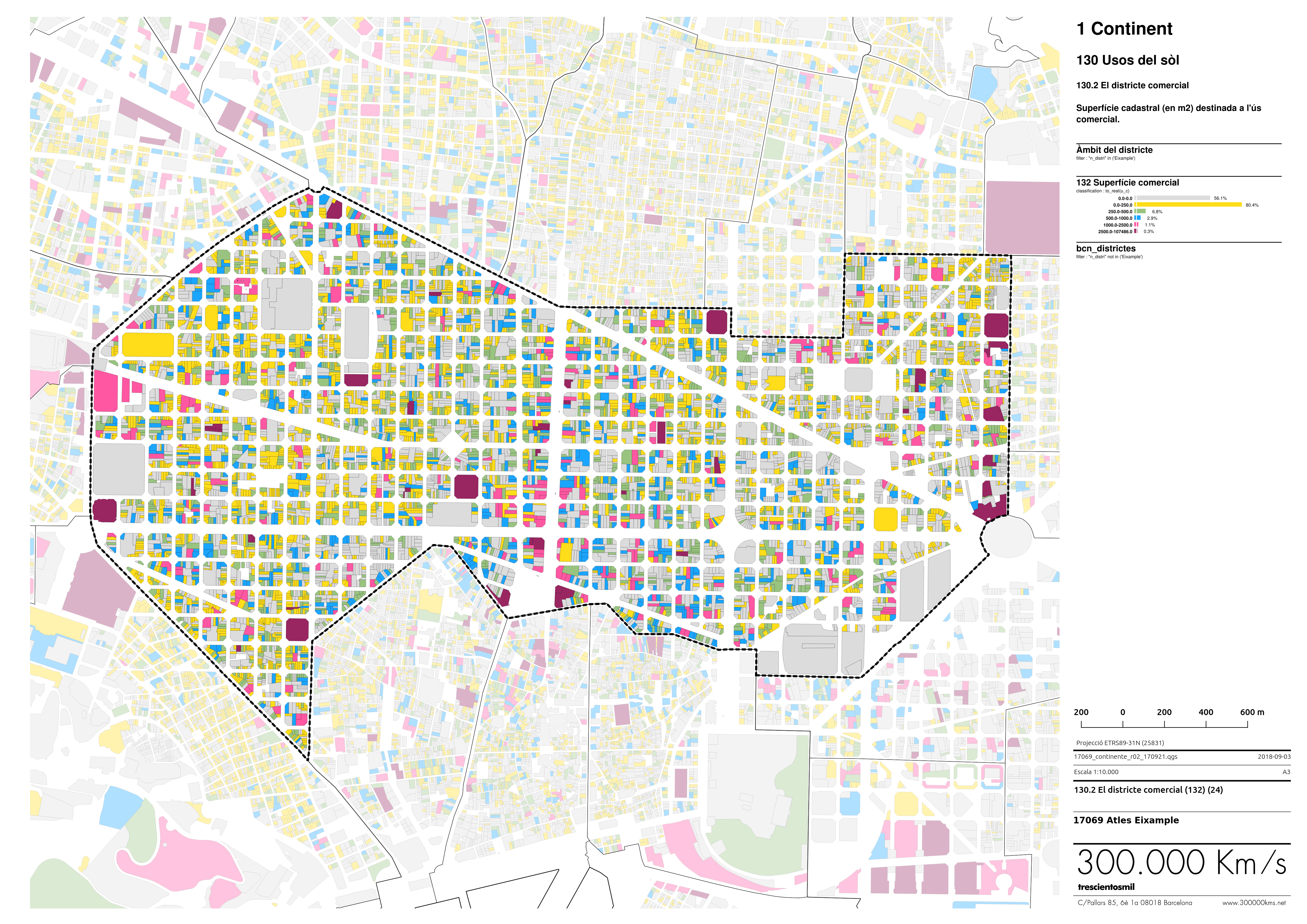
We created a set of maps that show multiple types of public, private and big data with several levels of detail and aggregation to trace the current uses of Barcelona’s Eixample district, as well as their impacts.
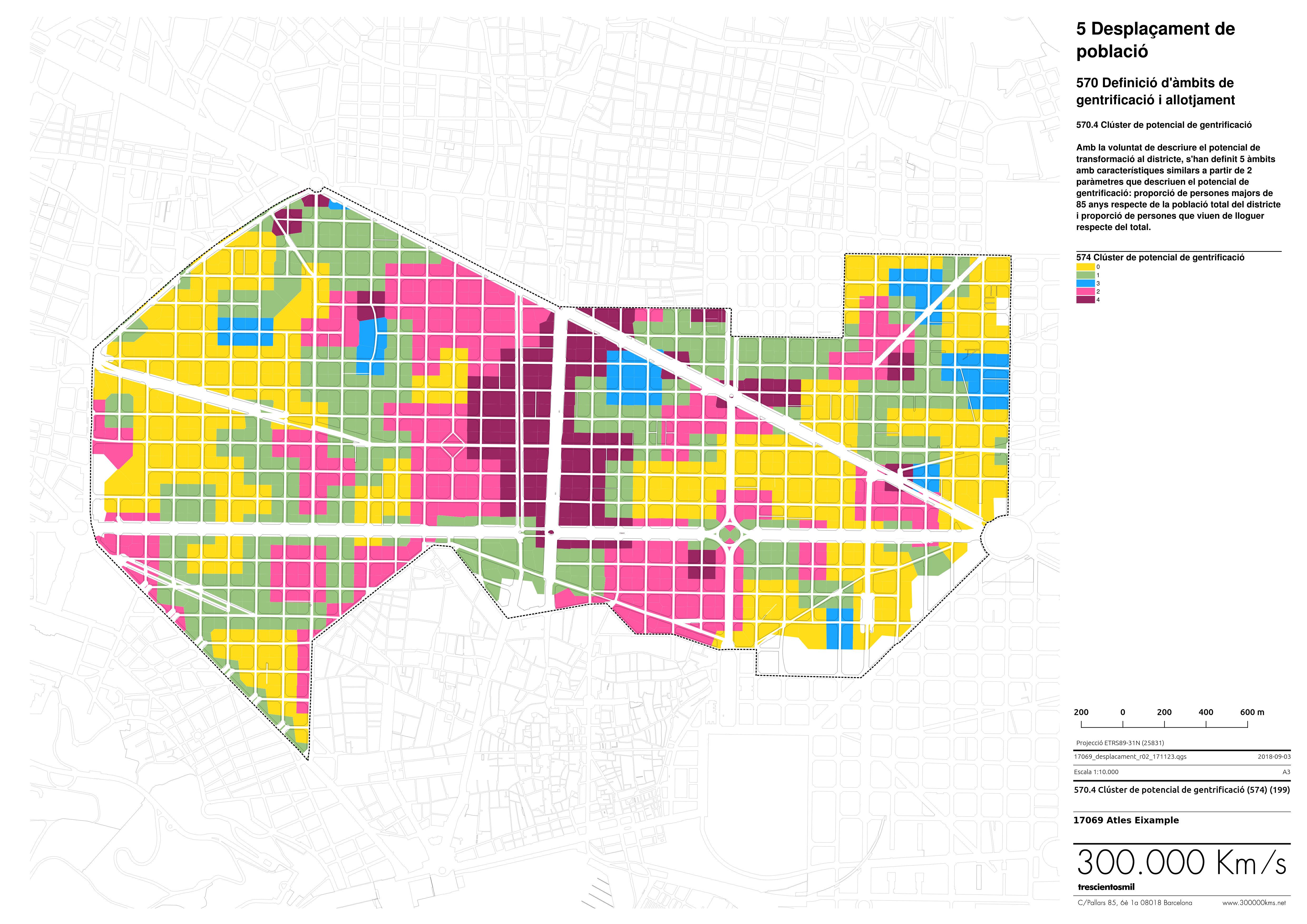
This implied characterizing the urban fabric through morphological and behavioral parameters, describing several correlations between business activities and the negative perceptions held by residents, as well as identifying various types of vulnerability arising from the transformation of uses in the district.
Images
Promoters

Ajuntament de Barcelona