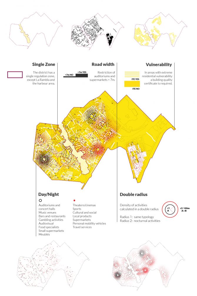
The Ciutat Vella land-use plan regulates the implementation of public businesses, food trade and tourist services in Barcelona’s central district. Over recent years, business activity in this district has increased and become more specialized due to excess tourist pressure and the ensuing displacement of businesses aimed at locals. Residents’ quality of life has been negatively impacted as a result, thanks to greater noise levels (which can seriously affect health), the saturation of public spaces, insufficient cleaning, and increased logistics.
We used cutting-edge spatial analysis techniques based on big data and predictive models, as well as citizen participation to shape dynamic regulations that can be simulated and assessed to ensure that both businesses and residents can thrive simultaneously in the district.
The land-use plan is the result of the collaboration between multi-disciplinary technical teams and citizens on a co-creation process that included online and on-site spaces for dialogue.
Images
Promoters

