Conference in Albacete (Spain) organized by the COACM
Retos del urbanismo rural

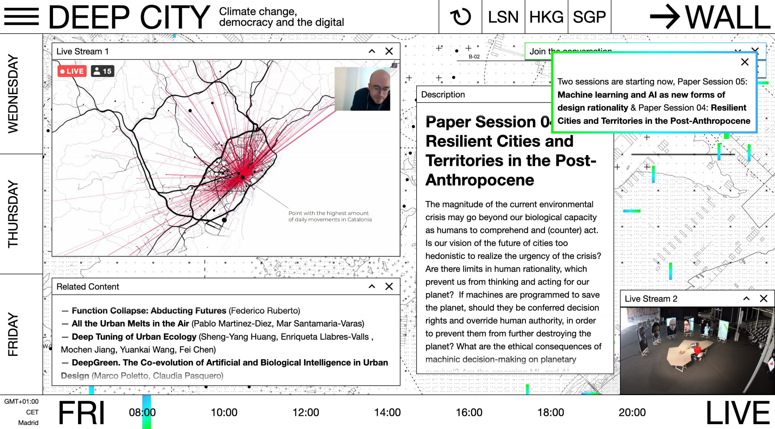
300.000 Km/s is a urban think tank


The A’U, an event organized by the Association of Urban Architects of Catalonia (AAUC), the COAC and the department of territory and sustainability, is a meeting place between technicians and managers of different levels, which allows to know and share a selection of the urban planning projects developed throughout the year.
It shares the current urban planning of Catalonia by building a dialogue between the outstanding experiences, whether due to their technical interest, to act in an emblematic space, to manage complex aspects…

The dialogue revolves around questions such as: Have we built cities and societies resilient to crises? Will the coronavirus change cities and societies as we know them? What new paths towards sustainability can the crisis open in cities?
Speakers such as the director of the Valencian Building Institute (IVE), Begoña Serrano; the geographer Oriol Nel·lo; Pablo Martínez, co-founder of 300,000 km / s; and Ramón Marrades, strategic director of La Marina.

The fifth Design to Live Conference, curated by Òscar Guayabero, was a parallel activity in the exhibition Emergency! Designs against COVID-19 with the objective of visualizing design strategies, ways and resources. Make it clear that design can contribute to making the probable future (the one that seems most likely to happen) as closely as possible to the desirable future (the one that is committed to the common good).

Nighttime as a Unique Territory
Architect and researcher Lucía Jalón Oyarzun, Professor of Urban Media Studies Will Straw, and architects Mar Santamaría and Pablo Martínez of 300.000 Km/s lectured on March 11, 2021 as part of MAS Context’s 2021 Spring Talks series.
Today, the ability to describe and understand urban environments based on the use of data allows us to develop new perspectives beyond what is visible. It is with this information that we can document and visualize the activity cycles that characterize each city, during daytime and nighttime. The available data is a tool to begin to understand how nighttime in each city is governed, the patterns it generates, and how it defines a unique territory and human experience of our built environment.
During this event, the panelists will share their ongoing research on nighttime conditions, from the policies that shape them to their representation in media. They will also discuss cartography as an instrument to define new territories and the different cities that those cartographies reveal.
This event is part of the ongoing Nocturnal Landscapes: Urban Flows of Global Metropolises initiative. The project provides a comprehensive look at global metropolises at night, combining analysis and observation, questioning the correlation of human activity and light, and revealing hidden aspects of our cities.
This event was supported by the Barcelona City Council – Institut de Cultura de Barcelona.


